THREE EYES ON THE CONGO!!!
Facts and Figures
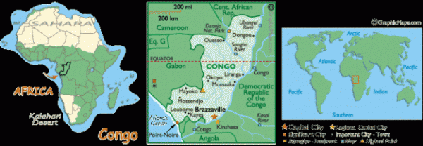
Official Name Republic of the Congo
Population 3,702,314
Capital City Brazzaville (1.3 million)
Largest Cities Brazzaville, Pointe Noire, Loubomo, Nkayi, Mossendjo
Currency Africaine Franc (XAF)
Currency Converter here
Latitude/Longitude 4�25' S, 15�26' E
Languages French (official), and tribal dialects
Flag here
National Day 15 August; Independence Day
Religions Christain, Animist,, others
Land
Land Area 341,500 sq km (131,853 sq miles)
Landforms From the grasslands of the narrow coastal plain, the land rise into a south-central plateau, and the elevated regions along its border with Gabon. Further inland and north, the land flattens, and is covered by a dense equatorial rainforest.
The Congo River, and its major tributaries (the Ubangui and Sangha), nourish the land. The entire river basin is swampy, and often flooded in the rainy season.
Highest Pt. Mt. Leketi (1,040 m) (3,410 ft)
Lowest Pt. Atlantic Ocean (0 m) (0 ft)
Land Divisions 9 regions and 1 commune*; including Bouenza, Brazzaville*, Cuvette, Kouilou, Lekoumou, Likouala, Niari, Plateaux, Pool and Sangha
CONGO NATURAL LIFE....
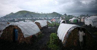
Central and northwestern DRC is home to the world’s second-largest rainforest after the Amazon and is largely impenetrable. Savannah and parkland are found north and south of the Congo River Basin, while mountains rise in the east. These, along with a series of lakes and the White Nile River, form the country’s eastern border. Approximately 1,000 miles separate Kinshasa from the country’s eastern frontier, and no direct cross-country roads or railways exist. Given the vast distances, challenging geography and lack of resources available to the central government, controlling the DRC’s regions is a major challenge for that government.
